Full name : Vyacheslav Dmitrievich Minchenko
In office: Since March 28, 1988
Position: Head of the Laboratory
The Laboratory of Engineering Geodynamics and Remote Sensing solves scientific issues on the nature of the formation and development of landslide processes.
The laboratory provides the following services:
assessment of the affected areas (river basins, administrative districts, regions) by landslide processes;
construction of medium and large-scale maps of landslide danger of the territory;
identification of landslide-prone zones and areas of development of landslide processes;
assessment of possible consequences of landslides for engineering structures, residential buildings and other objects;
assessment of the vulnerability of objects in the development of landslides;
risk assessments of possible consequences from the impact of landslides;
construction of large-scale space schemes of the landslide situation (district, river basin, administrative region) with parametric characteristics of landslide sites, allocation of zones of possible damage and danger to objects and structures, assessment of the dynamics of the development of territories and the development of landslide processes in time and area over the past 15-20 years.
Develops recommendations on the engineering and geological justification of complex schemes for the protection of territories from anthropogenic and engineering-geological processes, the study of the dynamic properties of soils taking into account seismicity and climatic zone, the study of the stability of rocks in the massif and stabilization of slopes; prevention of dangerous geological processes and deformations of structures; protection of objects from the effects of EGP. as well as means of measuring engineering-geological and hydrogeological parameters
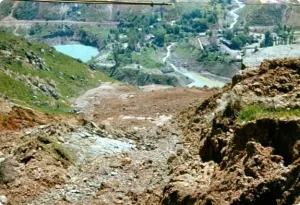
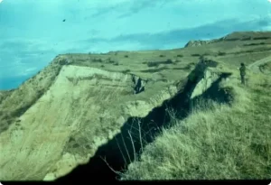
Problems of landslide prevention
Uncontrollability of the time of the beginning of their formation
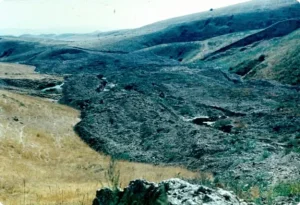
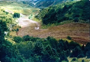
Massive, simultaneous manifestation in loess rocks (30-40 cases per day)
A big social problem
High speed (up to 3.5 m / s) and the length of movement (1.6-4.5 km)
Variability of the direction of movement, the height of the ejection to the opposite side and the area of propagation
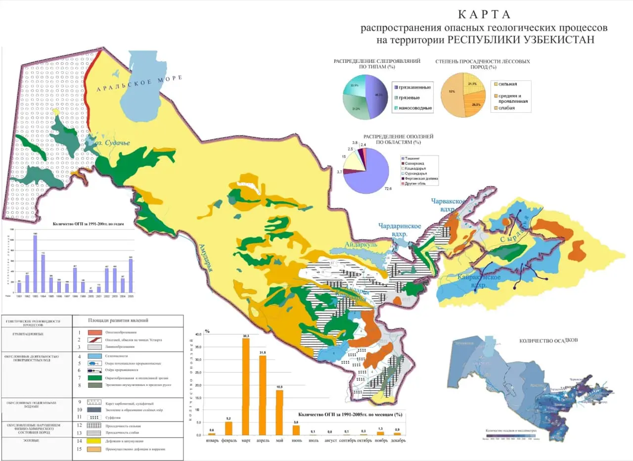
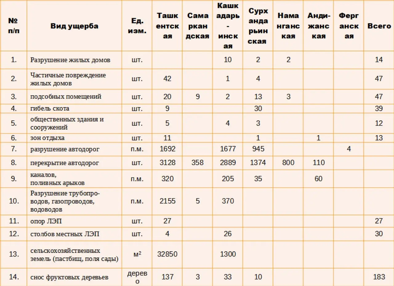
Damage caused by landslides in Uzbekistan over a ten-year period (1998-2008)
The number of landslide manifestations by decade
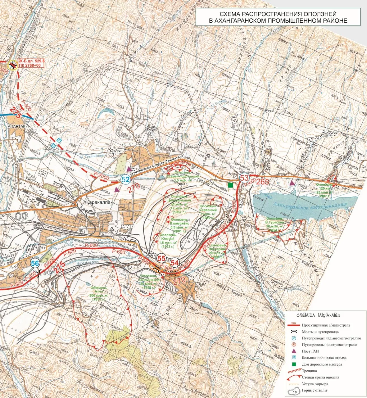
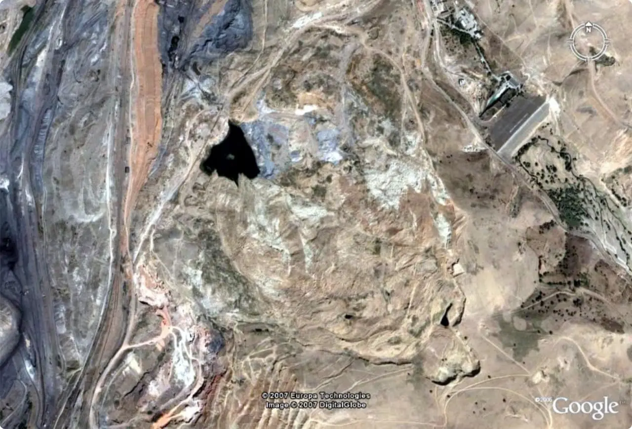
There are three major economic problems in the Angren zone that need to be resolved:
1. Choosing a safe option for the location and construction of a transport system consisting of a “package” of linear structures (highways, railways, pipelines, power lines, etc.);
2. Providing conditions for the prospective development of a coal mine in the north-west direction to increase the volume of coal production;
3. Building up and strengthening the dam of the Akhangaran reservoir to increase its volume.