GEOINFORMATION TECHNOLOGIES AND MODELING

Full name: Zhuraev Marcifali Turgunbayevich
On the position:  Since March 1, 2013
Position: Head of the Laboratory

The laboratory provides the following services:

  • Installation and commissioning of the telemetric module for automatic monitoring of groundwater in hydrogeological wells”;

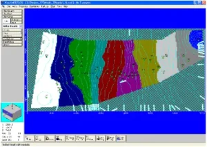
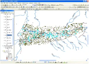
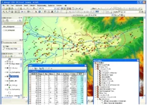
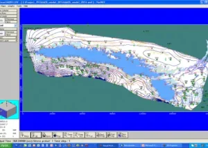
  • Georeferencing and raster vectorization;

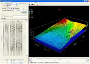
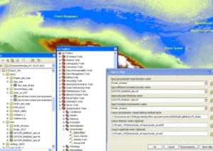
  • Spatial database design;

  • Computer cartography;

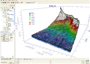
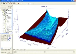
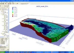
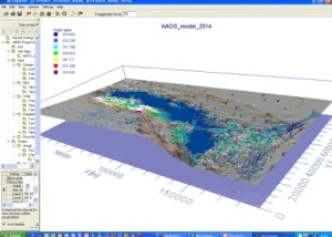
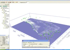
  • 3D geological modeling;

  • Development and compilation of cartographic reports;

  • Software development.

Main objectives of laboratory

  • • Development of mathematical models of groundwater deposits based on modern software products;

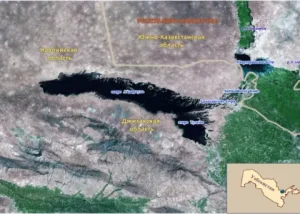
  • • Creation of natural, geofiltration and mathematical models of geofiltration processes in order to predict the behavior of groundwater levels and assess their quality based on modern software products; Construction and processing of hydrogeological and engineering-geological maps using GIS technology;

  • •Processing and generalization of geological, hydrogeological, geophysical and aerospace data using computer technology methods;

  • • Statistical processing of hydrogeological and engineering-geological data;

  • • Substantiation and improvement of groundwater monitoring methods;

  • • Development of computer technologies and devices for automatic measurement of the level, temperature and electrical conductivity of groundwater, relating to the conditions of Uzbekistan;

  • • The use and implementation of automated devices for measuring the ground water level, temperature and salimnity.

  • • Development and introduction into practice of modern software and modeling systems;

  • • Development of recommendations and guidelines for the application and implementation of mathematical methods for modeling, automated measuring instruments of geoinformation technology, as well as software.

Main results

Creation of modern digital hydrogeological 3D models for groundwater deposits of the Republic of Uzbekistan for processing the results of geological exploration, resource assessment and rational use (on the example of the Akhangaran river valley).

As a result of research for the 3D model, a factographic and cartographic basis of the hydrogeological information system, hydrogeological parameters and factors that determine the state of groundwater, hydrogeological conditions of the object of study were prepared, and materials were collected on the hydrogeological, geomorphological and water management conditions of the object of study.
The database created in the ArcGIS system includes cartographic material and tabular information that is entered into the attribute information of objects. 3D modeling was performed using the Visual Modflow program; as a result, digital maps of groundwater levels and the piezometric surface of the study area were compiled.

Study of the processes of groundwater damming and territory flooding under the influence of the Aidar-Arnasay lake system based on GIS technologies.

A set of sequential forms of diagrams, tabular, graphical and cartographic materials has been compiled as initial data for modeling, analysis and assessment of hydrogeological conditions in order to identify the causes and rates of changes in the state of groundwater in Neogene-Quaternary deposits under the influence of the AAOS.
A geofiltration model of groundwater deposits of Neogene-Quaternary sediments within the influence of the Aidar-Arnasay lake system based on modern software products Modflow and ArcGIS under anthropogenic impact has been created.

Development of a mathematical model of groundwater deposits on the example of the Fergana Valley in order to assess the predicted resources in connection with changes in water management conditions.

A geofiltration mathematical model of groundwater deposits in the Fergana Valley has been developed to identify the prospects for their use in the national economy, increasing the water supply of irrigated lands in conditions of technogenic low water.
With geofiltration schematization, the analysis of series of regime observations of the groundwater level and geofiltration parameters, Kf, Km, m, as well as retrospective data on water intakes, etc. was conducted.
In the course of the regional assessment of probable resources (PR) and operating reserves (OR), the regularities of groundwater formation, their balance, lithofacies conditions of occurrence of aquifers, hydrodynamic (and hydraulic) state of aquifers, the relationship between groundwater and surface water, etc.
A schematic map of various types of relationship between pressure and groundwater in the Fergana Valley has been created and a schematic 3D model of the groundwater level of the Fergana Valley has been built in Visual ModFlow.
The following tasks were solved on the basis of the created mathematical model: a) schematic map of various types of relationship between pressure water and groundwater in the Fergana Valley was created and a schematic 3D model of the groundwater level of the Fergana Valley was built in Visual ModFlow. b) groundwater extraction in a three-layer environment (periphery of alluvial fans, Central Fergana, the valley of the Naryn, Karadarya, Syrdarya river).